Most people recognize Los Angeles River as the set of some of Hollywood’s most iconic films. In 1978’s “Grease,” John Travolta competed against a rival greaser in a heated drag race under the 6th Street Viaduct. Ryan Gosling and Carey Mulligan sped down the river at breakneck speed in one of the few heartwarming scenes in the action thriller “Drive.” In the 1990s, premier action star and future-California Governor Arnold Schwarzenegger was forced down the LA River in James Cameron’s classic “Terminator 2: Judgment Day.”
Other than playing a pivotal cinematic role, the LA River is an important part of the city’s and county’s history, present and future. The river is vast, literally and figuratively. Stretching 51 miles from Canoga Park all the way down to its mouth in Long Beach at the LA Harbor, the LA River has an expansive range that flows through 17 river-adjacent cities.
Millions of drivers pass it over it every year, and nearly 1 million residents live within 1 mile of the river and provides “834 square miles of healthy watershed,” according to statistics provided by the LA County Department of Public Works (LACDPW). With that kind of impact, the LA River is an historical landmark.
Before Spanish colonists showed up in 1781, the LA River was the primary source of freshwater for the indigenous peoples and even contained the now-endangered steelhead trout. Nearby forests were home to wildlife who would also utilize the river.
Over time, more and more Europeans and white Americans from the east began settling in what we now know as LA County, building homes, businesses and cities adjacent to the river.
After an aggressive rainfall in 1938 in which the river overflowed beyond its banks and flooded neighborhoods throughout the county, the U.S. Army Corps of Engineers started encasing the river in a deep concrete trench that would prevent spillage during storm and flood seasons.
Focus on the Lower LA River
Though long stretches of the river feature little to no flow of water during the warmer times of the year, the 19 miles of the Lower LA River features some of the county’s most critical water conservation processes. Though not as prominent as the upper river, the lower river is a vital part in understanding the county’s plans for water conservation in the era of climate change, droughts and sustainability.
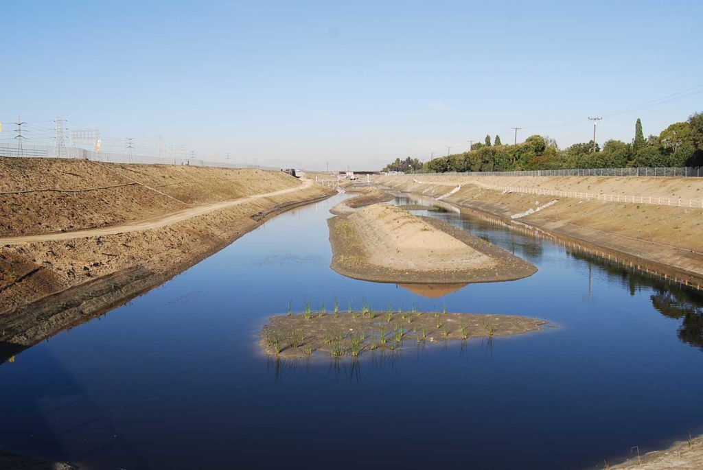
On a media tour through the Lower LA River on Thursday, Oct. 11, the LACDPW showcased the county’s water conservation processes which are currently in the process of enhancement. Natural vegetation grows along the Dominguez Gap Wetlands, which function as a natural habitat for wildlife as well as an offline water source to be sent back to the river or to water treatment plants.
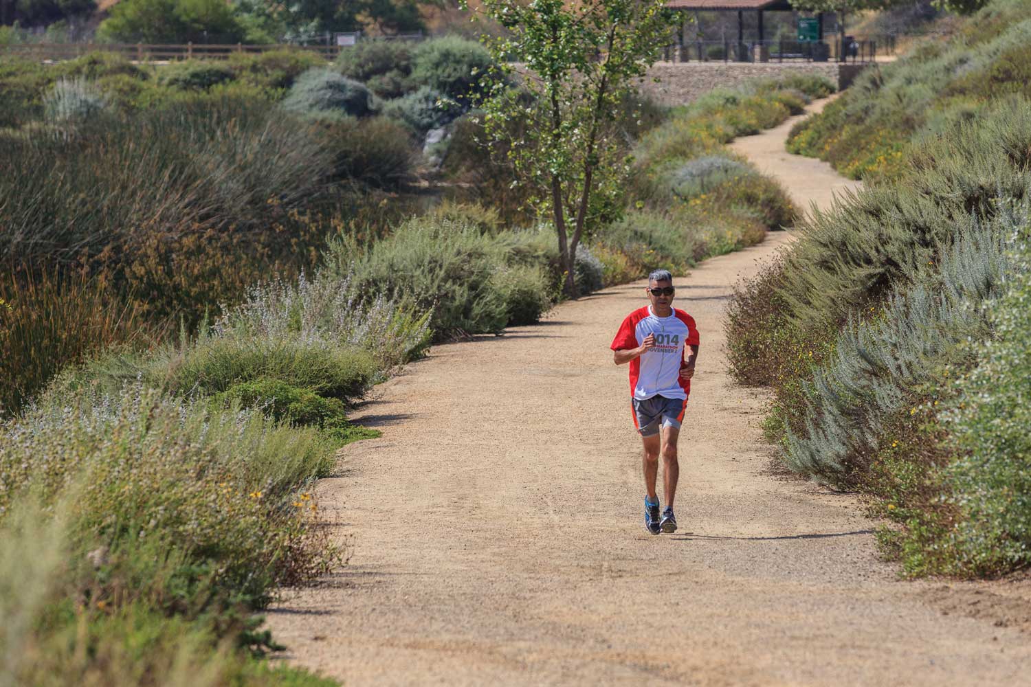
There are safety amenities for first responders to use in the event a person falls into the river. Recreational features like the walking trails and bike paths are located adjacent to the river.
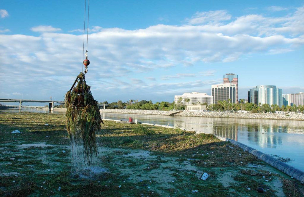
As you move further south down the river, the water level and velocity of flow increases until it reaches the trash boom in Long Beach, the “last line of defense” that uses two critical trash collection systems (one for floating trash and one for below-the-surface trash) that collects debris, vegetation and pollutants from urban and agricultural runoff.

Overall, the Lower LA River system is a complex system that controls filtration, transportation of water and pollution filtration, and the LACDPW is hoping to update the system with the upcoming Lower LA River Master Plan.
Under the LA County Board of Supervisors, the LACDPW will update the existing river plan, a broad, “multi-objective guide” for projects and research for the river pertaining to flood protection, environmental enhancement, recreational opportunities, restoration of habitat for wildlife, safety and improving public health.
Notably, there are hundreds of acres of unoccupied land that could be used to build parks and other public amenities that could help revitalize the river’s role in the greater LA community.
“There’s so much potential here for projects that could really put forth innovation in terms of water conservation in the county as well as provide a community benefit, which is why we’re looking forward to working with these river-adjacent communities to hear what they’d like to see come out of projects,” LACDPW senior civil engineer and project manager for the Lower LA River Master Plan Caroline Hernandez told reporters.
Amping up the county’s stormwater systems
Throughout its history, the county has been working on how best to maintain the river and combat problems that may arise during storm season, which typically falls from October to April each year.
Meteorologists and weather experts predict a 75 percent chance that the 2018-2019 storm season will be an El Nino year, which typically means more precipitation in the United States, especially southern California.
Measure W: Is it necessary?
Enter Measure W, a proposal to fund more county projects relating to LA River revitalization and stormwater management that LA County residents will vote on this upcoming midterm election. Measure W would impose a tax on private property owners a parcel tax which will fund stormwater capture and management projects as well as maintaining the LA River’s key features.

Homeowners and private business owners would be taxed 2.5 cents of every square foot of the property that water doesn’t soak into.
Two-thirds of the county’s fresh water supply comes from outside sources, meaning only one-third comes from the local supply. With the eminent threat of climate change, utilizing more sophisticated ways to capture and store more rain water could help the notoriously dry county be better prepared for droughts.
Currently, stormwater projects are financed through the General Fund, but Measure W would create a fund dedicated to stormwater management and conservation. The estimated revenue would be $300 million a year.


