

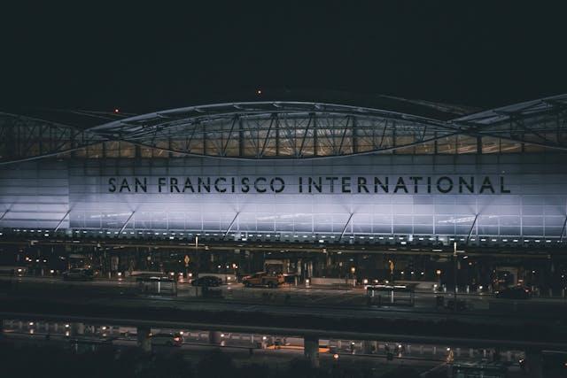
San Francisco International Airport (SFO), built on reclaimed land over former marshes, faces heightened risks from land subsidence and sea-level rise — a growing concern as much of the Bay Area experiences gradual sinking.
More than 92% of San Francisco is sinking — and new research warns that the gradual land subsidence, when combined with sea level rise and aging infrastructure, could spell a crisis for one of America’s most iconic coastal cities.
A peer-reviewed study published this month in Nature confirms that vast portions of the city — including downtown, Treasure Island, and areas surrounding the airport — are subsiding by as much as 10 millimeters (0.39 inches) per year. Unlike other parts of California where groundwater extraction drives subsidence, San Francisco’s problem stems largely from what lies beneath: artificially filled land.
Much of San Francisco’s eastern waterfront — including neighborhoods like Mission Bay, the Marina District, and Treasure Island — was built on reclaimed land. These areas were created by dumping rubble, sand, and debris onto bay mud and shallow waters, especially during the post-Gold Rush boom and early 20th-century expositions. Today, these filled lands are proving unstable, with soft sediments compacting under the city’s weight and slowly sinking over time.
When Land Sinks and Seas Rise
NASA models project that sea levels in parts of the Bay Area could rise by up to 17 inches by 2050 compared to 2000 levels. When land subsidence is added to that equation, the effective or relative sea level rise becomes even more dangerous — particularly for low-lying and waterfront neighborhoods.
One critical example is San Francisco International Airport (SFO), itself built on filled land. By mid-century, the airport could face a foot of relative sea level rise, jeopardizing runways, access roads, and vital transportation infrastructure.
In San Rafael’s Canal neighborhood — home to a predominantly immigrant and low-income community — residents are already dealing with tidal flooding that threatens homes and livelihoods. Continued sinking could further isolate or displace these families, deepening housing and equity challenges.
Infrastructure on Shaky Ground
“Subsidence accelerates the impacts of climate change,” said Dr. Manoochehr Shirzaei, a lead researcher in the study. “It’s not just the water rising — it’s the land falling. That double effect increases risks far faster than expected.”
The study’s authors emphasize that city planners and state officials must act quickly. Incorporating subsidence maps into building codes, updating flood control systems, and rethinking zoning near vulnerable areas will be essential to long-term resilience.
The San Francisco Planning Department has already developed a Sea Level Rise Action Plan, which assesses how city-owned buildings and infrastructure could be impacted. The city is also part of the National Flood Insurance Program (NFIP), offering federally backed flood coverage to qualifying residents — but researchers caution that financial coverage isn’t enough to protect physical infrastructure.
What This Means for Local Communities
Asian American and Pacific Islander communities — who make up a significant share of the Bay Area population — must be included in planning and response efforts. Many live in neighborhoods built on fill or near the waterfront, placing them at disproportionate risk of displacement and economic loss.
Organizations across the city are now advocating for equity-focused climate adaptation policies that prioritize vulnerable populations and support grassroots resilience efforts.
A Sinking Wake-Up Call
This new data should serve as a wake-up call not just for San Francisco but for all coastal cities grappling with climate change. A city built partly on artificial land, surrounded by a rising ocean, and underpinned by unstable ground has no time to waste.
The future of San Francisco — and its communities, infrastructure, and heritage — will depend on how seriously leaders take the challenge of sinking land and rising seas.
—
Sidebar
Reclaimed Land in San Francisco: Key Areas at Risk
- Mission Bay: Built over tidal marshland; now a growing tech and life sciences hub.
- Marina District: Developed on landfill from the 1915 Panama-Pacific International Exposition.
- Treasure Island: Entirely artificial island constructed in the 1930s.
-
SFO: Built on engineered fill; vulnerable to flooding and liquefaction.